Updated By: LatestGKGS Desk
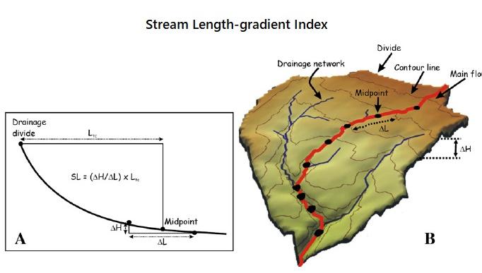
Stream Length Gradient Index Purpose, Features, Role in Geography

Stream Length Gradient Index (SL Index) Purpose, Features, Role in Geography
A geostatistical procedure is proposed to obtain SL index maps. A method is presented for validating and assessing the spatial distribution of SL.
The sensitivity of SL to detect the imprints of surface processes has been tested.
SL index is helpful for detecting large landslides on slopes connected to streams. SL is useful to solve geomorphological problems in different geological settings.
The aim of this work is to test an integrated quantitative geomorphic approach based on Stream Length–Gradient Index (SL Index) analysis within the small catchment of the Tarugo River in the Northern Marchman Apennines (Central Italy).
The Tarugo River basin, 92 km2 wide, strikes SW–NE across the MarcheanaRidge and the western sector of Marchena Piedmont.
The area is characterized by a series of NW–SE trending, NE verging thrust folds affecting the Meso–Cenozoic bedrock that passes upward from dominant carbonate to dominantly terrigenous rocks.
The area investigated has been affected since the Pliocene by extensional tectonics, accompanying a regional uplift decreasing in rate north-eastwards.
Results of this work indicate that the SL Index is a valid tool to detect the long wavelength structural effect on topography as well as the incipient local response to regional processes.


