Updated By: LatestGKGS Desk
Google's self-driving technology - Lidar Technology to deliver a driver-less car

History of Lidar Technology that is used in present day self driving cars
Lidar is an acronym for Light Detection and Ranging or a combination of Light and Radar.
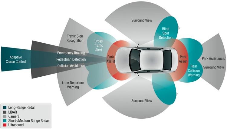
The use of Lidar sensor has made the automated driving in the driverless car possible.
Lidar is a surveying technique to measure the distance to a target using pulsed laser light.
The laser reconstructs a 3D image of obstacles in the path of the self-driving car.
The Lidar Technology is used to make high-resolution maps with application in many other fields.
The Lidar technology uses the principle of light travel and reflection to map the territory for navigation.
The Lidar technology is based on the same principle as the sonar technology still used in ships for navigation.
Lidar was first used in 1960 to map the surface of the moon on the Apollo 15 Mission.
One of the most popular uses for the Lidar technology is in Archaeology to map large-scale swaths of land.
The first use of Lidar for self driving was in the 20005 Grand DARPA Challenge using a 2D Lidar System.


