Updated By: LatestGKGS Desk
Land-forms: Karst topography, formation, chemicals, characteristics, distribution

Geological reactions and development of Karst topography from the dissolution of soluble rocks
It is a simple geomorphic cycle as it involves one surface (limestone) and one process (solution). It is fluvial transformation on limestone
Landforms produced by chemical weathering or chemical erosion of carbonate rocks mainly calcium carbonate (CaCO3, limestones) and magnesium carbonate (dolomites) by surface and subsurface water (groundwater) are called karst topography which refers to characteristic landforms produced by chemical erosion on crystalline jointed limestones of Karst region of erstwhile Yugoslavia situated along the eastern margin of Adriatic Sea.
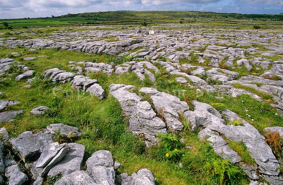
The Karst region of erstwhile western Yugoslavia extends for 480 km in length and 80 km in width. The region having folded limestones rises to the height of 2,500m AMSL. The surface studded with numerous solution holes, ravines, gullies, clefts, lapses and narrow valleys has become so corrugated and rough that it becomes practically impossible to walk with bare feet.
Karst topography generally develops in those areas where thick beds of massive limestones lie just below the layer of surficial materials. Besides, karst topography also develops in dolomite, dolomitic limestones, and chalks. Besides typical karst region of erstwhile Yugoslavia, karst topography has well developed in Causes Region of southern France; Spanish Andalusia; northern Puertorico; western Cuba; Jamaica; southern Indiana, west-central Kentucky, Virginia, Tennessee and central Florida of the USA.
these areas are classified as major karst areas. Besides, there are a few minor karst areas e.g. Carlsbad area of the USA, chalk area of England (Peak District), chalk area of France, Parts of the Jura mountains, some parts of Alps and Apennines. Limestone topography in India has not been properly identified and studied because of nonexistence of extensive thick limestone formations near the surface.
It may be pointed out that difference of opinions about the formation of caverns and galleries is related to solution process, water table of groundwater and corrosion process.


